This is a seriously interesting 106-page cross-disciplinary study exploring - with its main focus the Isle of Wight - the use of historical artwork as data for past coastal profiles. Such data can be unreliable: for instance, artists exaggerated cliffs for dramatic effect and, the paper notes, publishers even commissioned artwork from artists who'd never even been to the depicted place. But the accuracy can often be assessed by correlation with later photogaphs, and many artworks are photorealistic in their depictions of coastscapes.
Check the paper out even if you just look at the pictures; it showcases a lot of lesser-known Wight artworks and artists. Much of the text is pretty dry stuff about sources and methodology, but there are also plenty of specifics. The subsection "A description of the landscape paintings of the Study Area" is particularly good as a history of the artists (and the mid-Victorian intelligentsia in general) for whom the Island was a magnet. There are also nice case studies comparing images from different times/sources, and an extensive glossary of the cited artists and their relevant works.
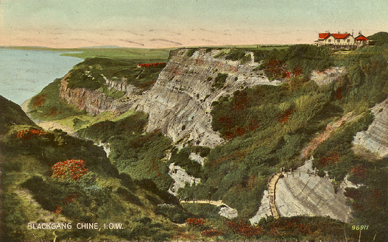
As an example, here's one remarkable photo (undated and uncredited) of the western end of the village of Blackgang. The report says:
The small village of Blackgang (below) developed in the mid-19th century close to a rapidly eroding and unstable cliffline. The development was speculative at a time of enormous demand for seaside residences on the Isle of Wight. Coastal erosion and instability, probably aggravated by development activities, has resulted in the loss of all the land and property in the foreground, including the hill in the mid-distance, roads and most of the terrace of cottages.
 |
| click to enlarge |
Low-resolution image reproduced in accordance with dissemination statement: McInnes, R. 2008. Art as a tool in support of the understanding of coastal change. The Crown Estate, 106 pages, ISBN: 978-1-906410-08-7 First published 2008
For comparison, see this bird's-eye view from Bing Maps. It's centred on what remains of the row of cottages - The Terrace - at top right in the above photo (you can see the same cottages in the distance in this postcard). The viewpoint of the above image appears to be grid ref SZ 48403 77036, now somewhere in mid-air above the mud slip.
- Ray
No comments:
Post a Comment